


Willington Voting District, McCormick County, South Carolina
About
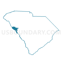
Outline

Summary
| Unique Area Identifier | 666353 |
| Name | Willington Voting District |
| County | McCormick County |
| State | South Carolina |
| Area (square miles) | 44.88 |
| Land Area (square miles) | 42.66 |
| Water Area (square miles) | 2.23 |
| % of Land Area | 95.04 |
| % of Water Area | 4.96 |
| Latitude of the Internal Point | 33.99322020 |
| Longtitude of the Internal Point | -82.42351480 |
Maps


Graphs
Select a template below for downloading or customizing gragh for Willington Voting District, McCormick County, South Carolina


Neighbors
Neighoring Voting District (by Name) Neighboring Voting District on the Map
- 1811-A - MIDWAY Voting District, Lincoln County, GA
- Abbeville No. 3 Voting District, Abbeville County, SC
- Lebanon Voting District, Abbeville County, SC
- McCormick No. 1 Voting District, McCormick County, SC
- Mt. Carmel Voting District, McCormick County, SC
- Savannah Voting District, McCormick County, SC
Top 10 Neighboring County Subdivision (by Population) Neighboring County Subdivision on the Map
- Abbeville CCD, Abbeville County, SC (11,774)
- McCormick CCD, McCormick County, SC (5,759)
- Lincolnton CCD, Lincoln County, GA (3,707)
- Mount Carmel CCD, McCormick County, SC (2,356)
Top 10 Neighboring Place (by Population) Neighboring Place on the Map
Top 10 Neighboring Unified School District (by Population) Neighboring Unified School District on the Map
- Abbeville County School District, SC (24,326)
- McCormick County School District, SC (10,233)
- Lincoln County School District, GA (7,996)
Top 10 Neighboring State Legislative District Lower Chamber (by Population) Neighboring State Legislative District Lower Chamber on the Map
- State House District 117, GA (64,224)
- State House District 11, SC (32,278)
- State House District 12, SC (31,604)
Top 10 Neighboring State Legislative District Upper Chamber (by Population) Neighboring State Legislative District Upper Chamber on the Map
- State Senate District 24, GA (182,334)
- State Senate District 25, SC (97,189)
- State Senate District 10, SC (84,695)
Top 10 Neighboring 111th Congressional District (by Population) Neighboring 111th Congressional District on the Map
Top 10 Neighboring Census Tract (by Population) Neighboring Census Tract on the Map
- Census Tract 9202, McCormick County, SC (5,759)
- Census Tract 9505, Abbeville County, SC (5,701)
- Census Tract 9701, Lincoln County, GA (3,707)
- Census Tract 9201, McCormick County, SC (2,356)
Top 10 Neighboring 5-Digit ZIP Code Tabulation Area (by Population) Neighboring 5-Digit ZIP Code Tabulation Area on the Map
- 29620, SC (12,934)
- 29835, SC (6,566)
- 29628, SC (2,759)
- 30668, GA (1,924)
- 29848, SC (751)
- 29840, SC (251)